The neighbourhood’s past, and a few moments worth remembering.
December 2025
The winter the waxwings came
In December 2025, James Square welcomed a small flock of Bohemian waxwings. These striking birds, known for their crests and soft colouring, are only occasional visitors to the UK and are usually seen when food becomes scarce in their usual northern habitats.
You may have noticed birdwatchers with cameras around the square. They were photographing the waxwings feeding on the berry trees around the buildings.
Photographs kindly shared by members of the Lothian Birdwatch Facebook group.
Waxwings are distinctive winter visitors recognised by their smooth plumage, crested heads and flashes of red and yellow on their wings.
The birds seen at James Square were Bohemian waxwings, a species that breeds across the northern forests of Scandinavia and Russia. During some winters, food shortages push them further south in what are known as “irruption years”.
These movements can bring large flocks into towns and cities, where berry trees provide an important food source. Seeing them locally is considered a special and relatively rare event.
History
Dalry and James Square
How Dalry changed from rural estate land to an industrial hub and residential neighbourhood, and the setting that shaped James Square.
Dalry before urban development
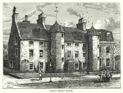
Until the late eighteenth century, Dalry remained largely rural and lay beyond Edinburgh’s formal town boundary. The area consisted primarily of agricultural land associated with Dalry House, a seventeenth-century estate that stood as the principal settlement in the district. Although Dalry sat on the western approach to the city and was crossed by routes linking Edinburgh with the west, it remained sparsely developed for much of this period.
This rural character began to change decisively in the early nineteenth century as Edinburgh expanded westward. The transformation of Dalry was driven by improvements in transport infrastructure and the rapid growth of industrial employment across the western edge of the city.
Railways and industrial expansion
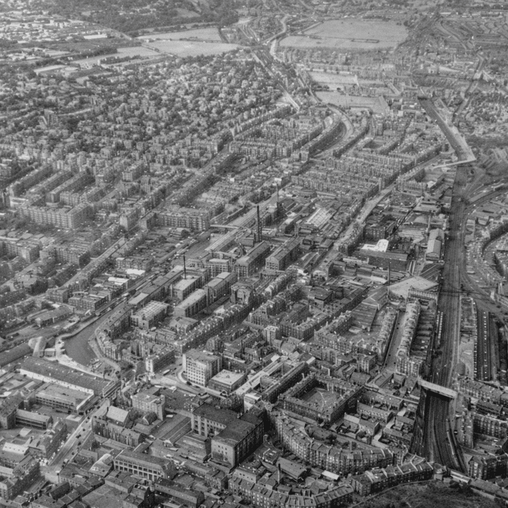
The opening of Haymarket Station in 1842 marked a fundamental shift in Dalry’s development. Haymarket quickly became Edinburgh’s second major railway hub, surrounded by extensive sidings, goods yards, and branch lines spreading west and south. The arrival of the railway brought industry with it, reshaping the area both physically and socially.
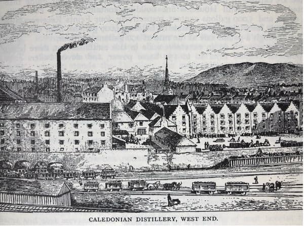
Large numbers of skilled and semi-skilled workers were employed by the Caledonian Railway, while nearby industries such as brewing, rubber manufacturing, and whisky distilling expanded to take advantage of rail access. The Caledonian Distillery, which opened in 1885, became one of the most prominent industrial landmarks in the district and a defining feature of Dalry’s western skyline.
This concentration of employment created immediate demand for housing within walking distance of workplaces, prompting rapid residential development across the surrounding streets.
Victorian housing and Caledonian Crescent
From the 1860s onward, Dalry was systematically urbanised. Landowners and speculative builders laid out new streets of sandstone tenements designed to accommodate the better-paid segment of the working population, particularly those employed by the railways and nearby industries. Caledonian Crescent formed part of this late-Victorian expansion and was developed primarily during the 1870s and 1880s.
The street was characterised by substantial stone tenements arranged in a regular and planned layout, reflecting a deliberate approach to urban development rather than piecemeal growth. Its proximity to Dalry Road, Haymarket Station, and major employers made it a practical and desirable location. While Caledonian Crescent was not conceived as elite housing, it was solid, respectable, and well situated within the expanding city.
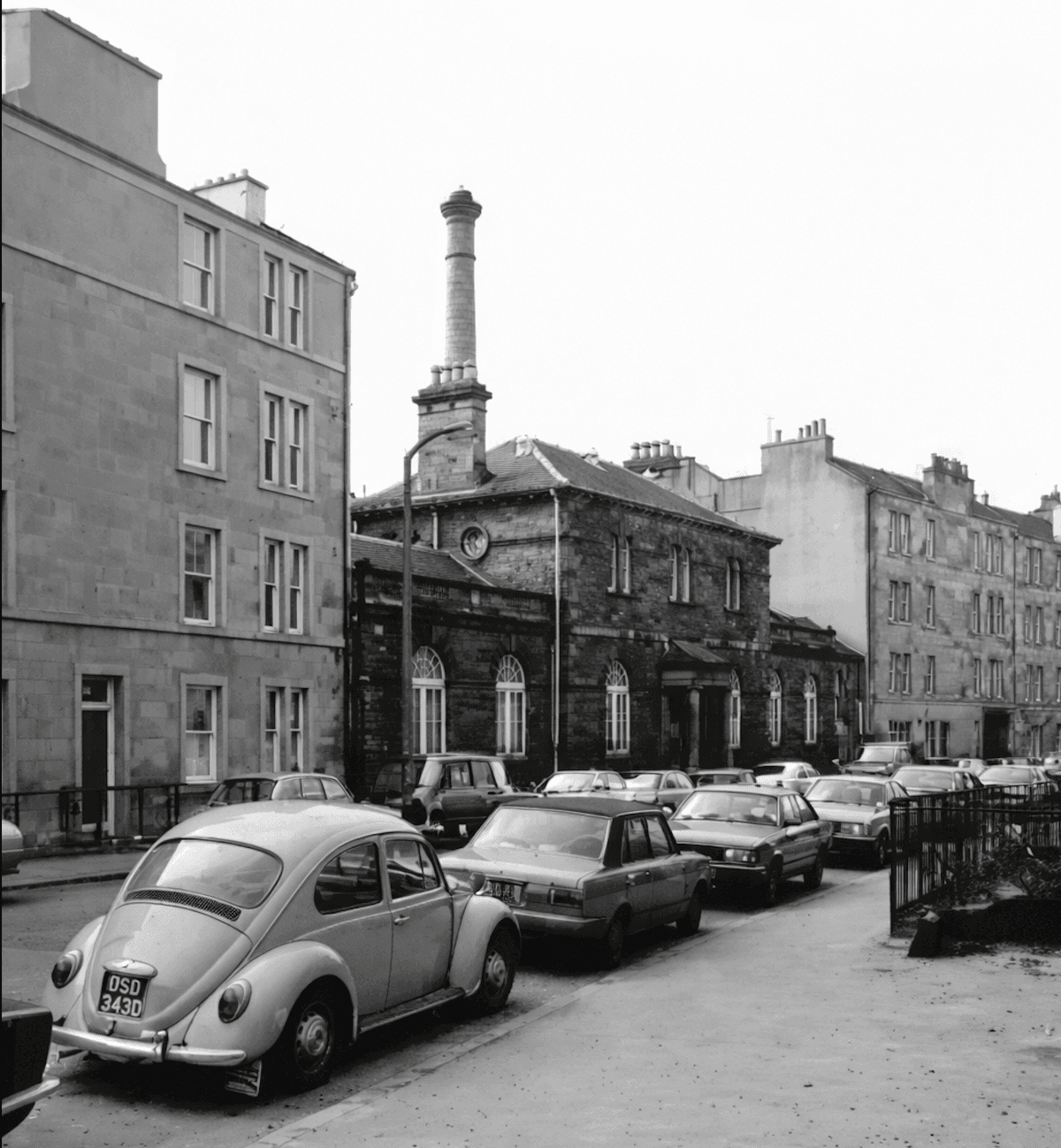
The establishment of supporting community infrastructure reinforced Dalry’s status as a settled neighbourhood. The opening of the Dalry Public Baths in 1897 provided a significant civic amenity and marked the transition of the area from an industrial fringe to a fully established urban district.
Dalry Road as a transport and commercial spine
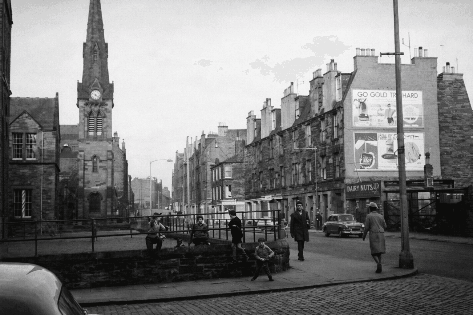
Dalry Road functioned as the main artery through the district, carrying horse trams, heavy pedestrian traffic, and a dense mix of shops, schools, churches, and public houses. The road linked residential streets such as Caledonian Crescent to places of work, commerce, and worship, forming the social and economic backbone of the area.
The opening of a local railway station on Dalry Road in 1900 further strengthened its importance, although the station later closed in 1962. By the early twentieth century, Dalry had been fully absorbed into Edinburgh’s urban fabric, with little remaining trace of its earlier rural character.
Post-war decline and land clearance
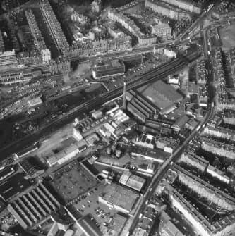
Following the Second World War, Dalry entered a period of transition. Rail use declined, heavy industry contracted, and large areas of railway land became redundant. This was particularly evident south of Dalry Road and west of Haymarket, where extensive sidings and yards were gradually abandoned.
By the 1960s, significant tracts of land had become derelict or underused, creating physical gaps within the urban fabric and weakening connections between long-established residential streets.
The West Approach Road and physical separation
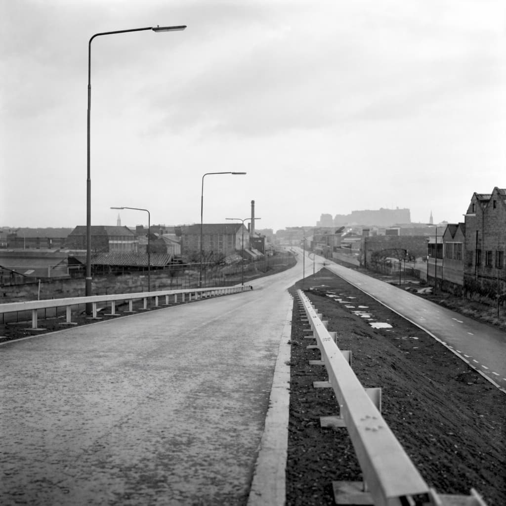
During the late 1960s and early 1970s, Edinburgh adopted a modern traffic strategy focused on improving vehicular access to the city centre. This resulted in the construction of the West Approach Road, much of which followed former railway alignments.
The impact on Dalry was profound. Large areas of former rail land were cleared, established pedestrian routes were severed, and parts of the neighbourhood became enclosed by major infrastructure. While the new road improved access to the city centre, it also left behind isolated parcels of land adjacent to streets such as Caledonian Crescent.
The context for James Square
By the late 1970s and early 1980s, Dalry presented a clear contrast. It remained close to the city centre and well served by transport, yet bore the physical legacy of industrial decline and large-scale infrastructure projects. Former railway and service land near Caledonian Crescent became increasingly attractive for private residential redevelopment as demand for city-centre living returned.
It was within this setting that James Square was conceived.
James Square: development and design
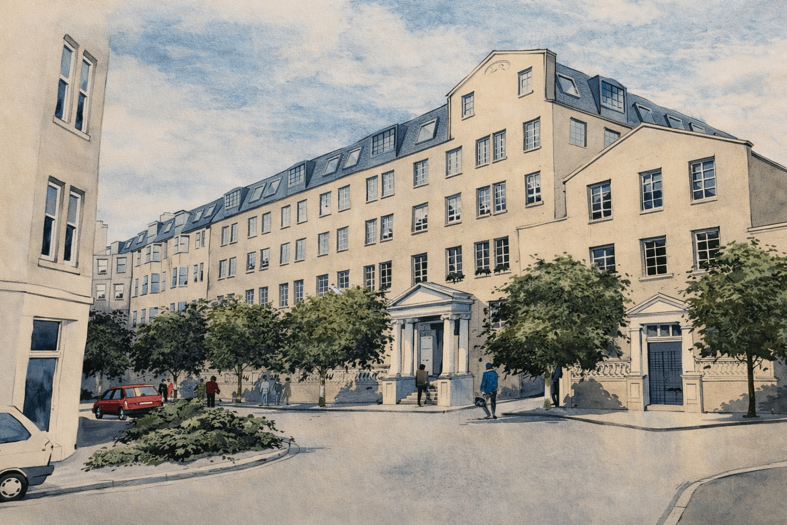
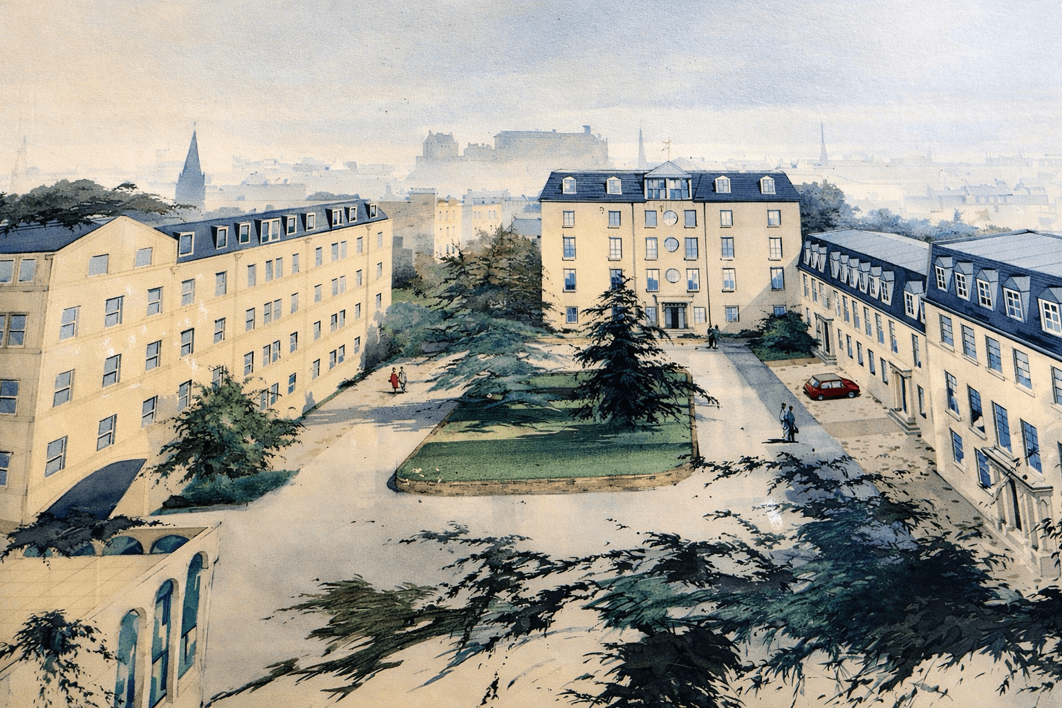
James Square, located on Caledonian Crescent, was constructed in the mid-1980s as a private residential development. It was designed from the outset for private ownership and was not a council or housing association project. Unusually for its time, the development incorporated shared amenities such as a private swimming pool, gym, and sauna, reflecting a shift toward amenity-led urban living.
The inward-facing courtyard layout responded directly to its surroundings, turning away from the West Approach Road and adjacent infrastructure in favour of a contained communal space. Public records do not definitively identify the developer or architect, nor do they clearly establish whether the site replaced specific buildings or previously cleared land. This lack of detailed archival record is typical of many private developments from the 1980s.
James Square exists as a direct consequence of earlier changes to the area. The decline of the railways, the clearance of industrial land, and the construction of the West Approach Road created the conditions that made this form of redevelopment both possible and desirable. Today, James Square sits quietly within a neighbourhood shaped by more than a century of layered urban change.
Some historical images have been restored or adapted and are for illustration only.